Geology rocks, but geography is where it’s at.
When Canterbury Museum first opened on 30 September 1870, a map created by Museum founder Sir Julius von Haast was displayed high on the wall.
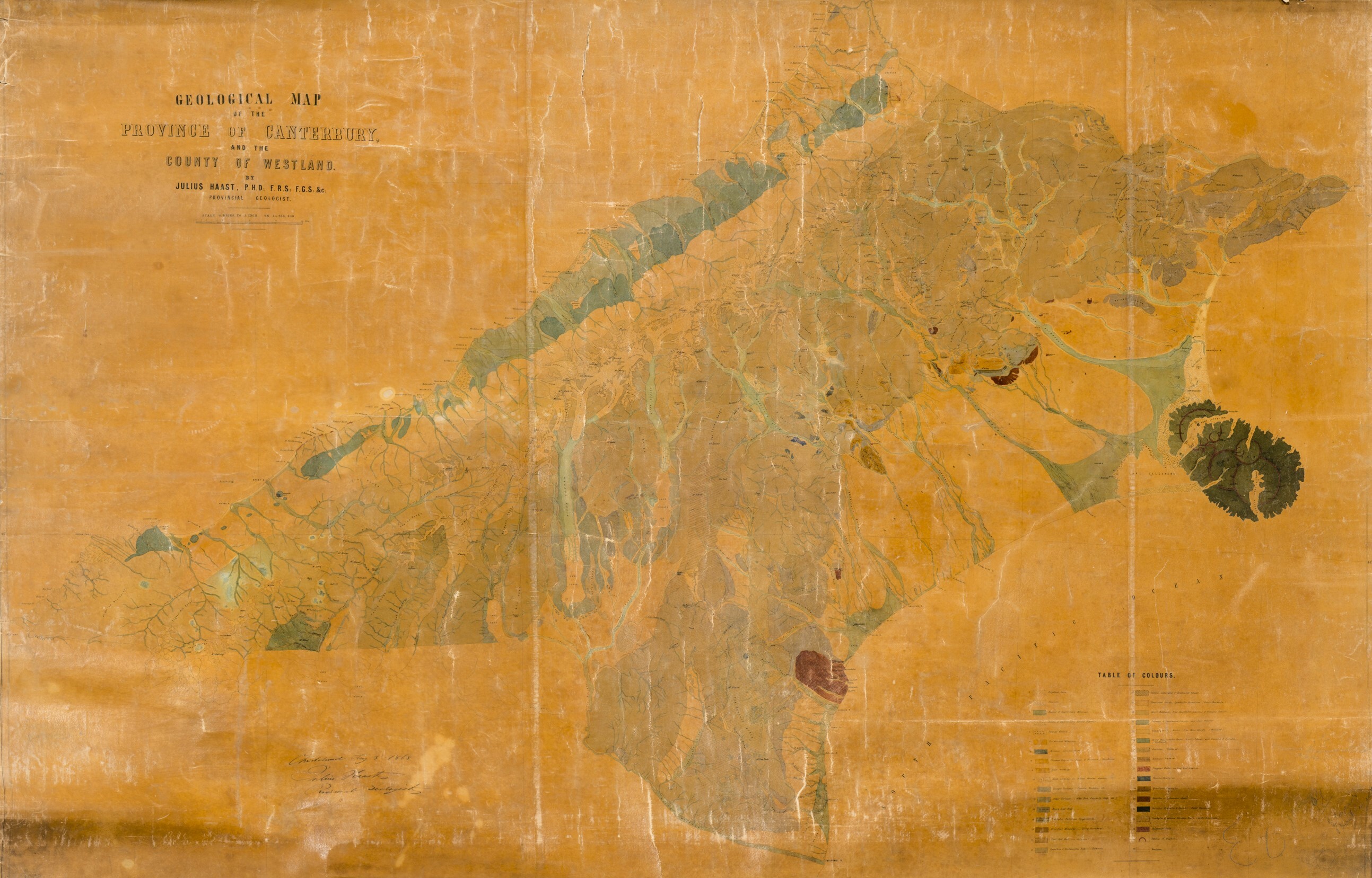
It was a map of Canterbury and Westland forged from Haast’s many years travelling across the South Island as the Provincial Geologist of Canterbury from 1861 to 1868. Its many hard-won details of New Zealand’s geology and geography were gained by trekking the country, collecting rocks, and painstakingly surveying the landscape. The thousands of geological samples he collected are still held in the Museum collection. Published in 1868, it was one of many maps Haast helped create and testament to his passion for geology and geography.
However, the rapid growth of the collection meant new buildings were needed, which were constructed shortly after the Museum opened. Exhibition layouts changed swiftly on the completion of new gallery spaces. As the Museum galleries developed, the map was eventually removed from display sometime around the turn of the twentieth century. The map disappeared into the Museum collection and was not sighted for many decades, until a request by Canterbury Museum Research Associate Dr George Hook set off a quest to find it.

One of Hook’s research interests involves testing Haast’s historical surveying against current-day knowledge of New Zealand’s geology. To undertake this work, he needed to view this map. But we couldn’t find it. We knew it was in the collection, but it's location was not recorded.
Canterbury Museum has 2.3 million objects in the collection. In the past, like many museums, objects sometimes entered the collection without being properly documented. About a third of the objects in one of the basement storerooms at the Museum’s Rolleston Avenue building had no record in the database.
Museum staff are currently working on a lengthy project to create a digital inventory of the entire collection. The project, which began in 2017, has so far added 545,000 objects to the Museum’s database. Ultimately, every treasure we care fore will have a photograph, a number, a description, and a location. The project will also help in the design of new exhibitions for the redeveloped Museum. The greater our knowledge of the treasures in our collection, the richer the exhibition experience will be.
But, in the meantime, it is still sometimes hard to find things.
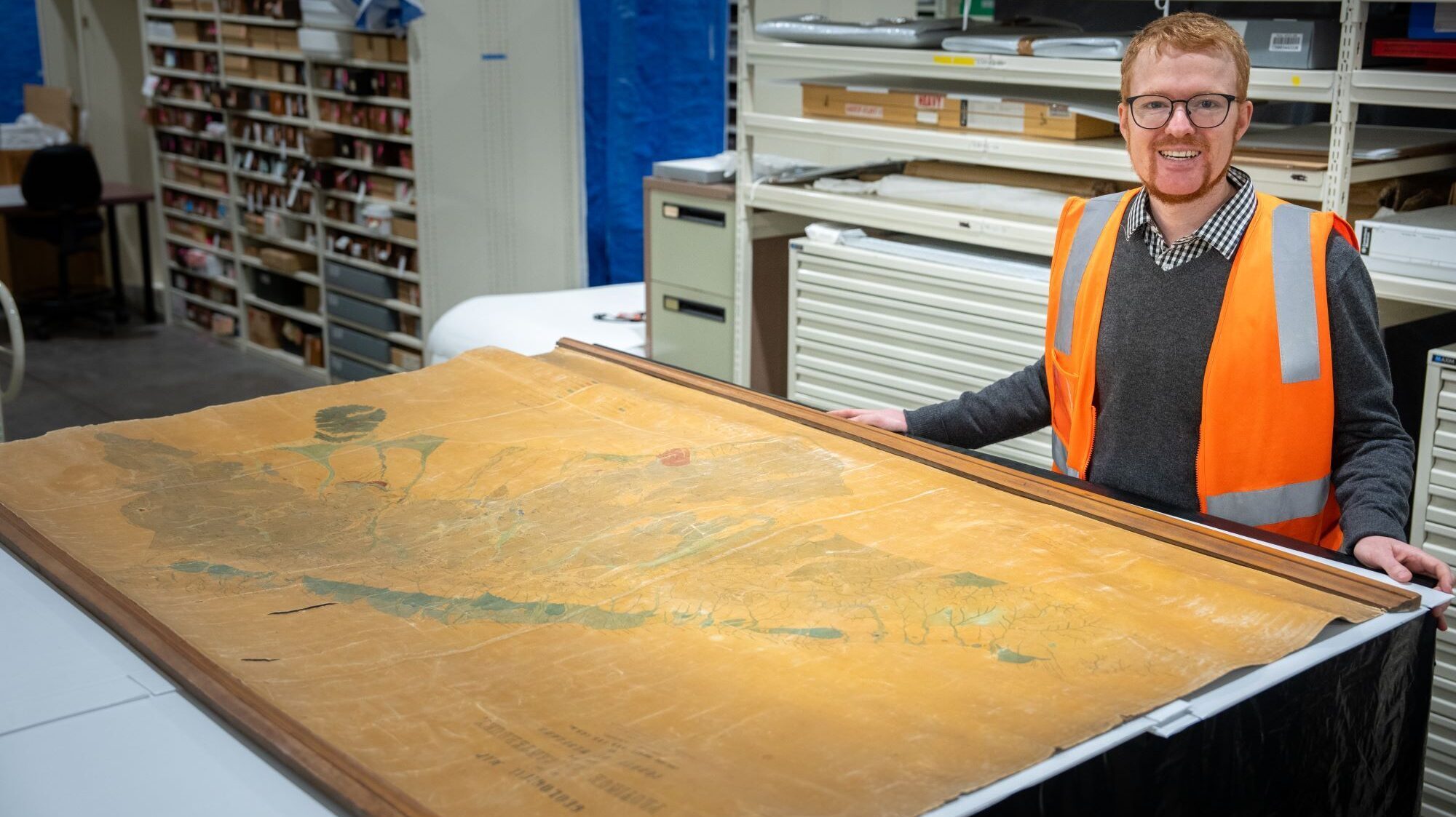
Given the significant size of the map, at 120 cm high by 180 cm wide, I thought it would be easy to find. This wasn't the case. Two full days of searching map storage locations proved unfruitful. But then I had a breakthrough. I spied a suspiciously labelled tube tucked away on top of a storage unit. The label read "Canterbury + Westland Julius Haast, 1968".
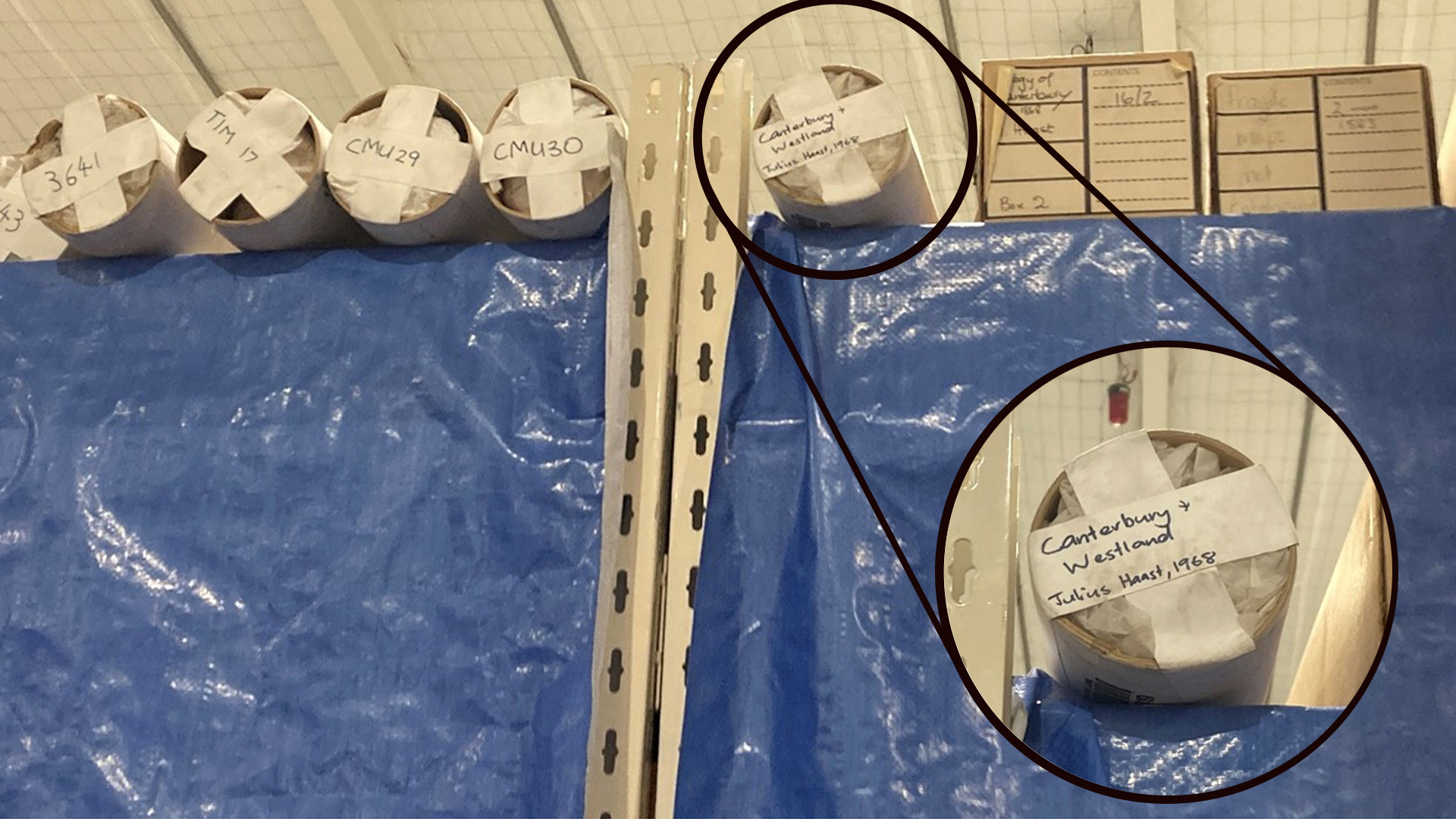
Excitement promptly followed. The label was promising as it noted both "Julius Haast" and "Canterbury + Westland". But the date didn’t make sense. Haast lived from 1822–1887. How could this map have been produced by Haast if he was long dead by 1968? We retrieved the tube from the top of the storage compactor and opened it. To my great delight, it held Haast’s 1868 geological map of Canterbury. It turns out that the person who labelled the box wrote the wrong century.
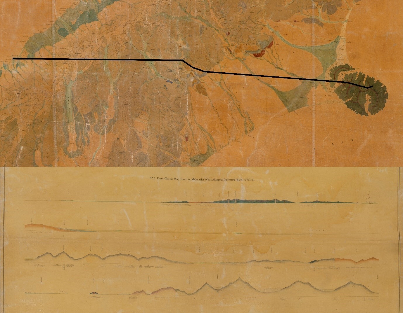
This map was produced by Haast as part of a series. It has lines drawn across the South Island, known as geological sections, that correspond with a separate map. The separate map shows the lines as cross sections complete with elevations and rock types. One cross-section runs across the South Island from Okains Bay in Te Pātaka-o-Rākaihautū/Banks Peninsula to Makawhio / Jacobs River on Te Tai Poutini/West Coast. The map and the corresponding cross sections hung side by side in the Mountfort Gallery on the Museum's opening day in 1870.
With the maps finally located, Hook and his colleague, geologist Dr Simon Nathan (Emeritus Scientist at Earth Sciences New Zealand), could compare them to our current knowledge of New Zealand geology. They concluded that Haast’s work was mostly accurate.
You can read their research in the 2025 Records of the Canterbury Museum. Finding this map and making it accessible to researchers has added significantly to our knowledge of Haast’s early scientific career.
Providing access to the collection is a key feature of a museum’s role. Once Canterbury Museum reopens after the redevelopment, more objects from the collection will be on public display than ever before. The Mountfort Gallery will be restored in the original style of the opening exhibition in 1870 and Haast’s great geological map will return to this gallery once again for all to see.